This article contains affiliate links. If you book through them, we may earn a small commission — at no extra cost to you. This helps support the project.
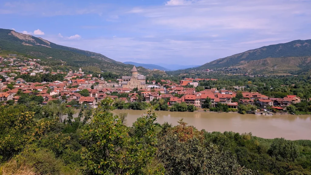
On the hills and river valleys outside Mtskheta lie the remains of a place that once stood at the center of royal and religious life in ancient Georgia. Armazi was the fortified royal center of Mtskheta, the capital of the Kingdom of Kartli. Palaces, pagan sanctuaries, baths, wine cellars and defensive walls once occupied this landscape above the Kura River. Walking through the ruins today means entering one of the places where an early Georgian state took shape.
This full-day route is designed for travelers who enjoy hiking, exploring archaeological sites and discovering historical places beyond Georgia’s best-known landmarks. Some sections have established paths, while others feel almost abandoned, with walls hidden by tall grass, limited signs and archaeological structures exposed beneath the open sky.
The complete route is designed as a self-drive itinerary with several separate walking sections. For more information on transportation, vehicle requirements, trail conditions and what to bring, see the trip-planning FAQ below.
Armazi Ruins Hiking Route Map
The interactive map is divided into five layers:
- Armaztsikhe–Bagineti shows the two parking options, the walking route through the ancient royal acropolis, and its individual archaeological structures.
- Armazi Gorge and Armazi Fortress includes the suggested parking area, Armazi Monastery, the river crossing, the forest trail, and the medieval fortress.
- Armaziskhevi Archaeological Site marks the entrance through the Armazis Tskaro restaurant and the Pitiakhshi Necropolis.
- Optional Stops After the Hike includes Pompey Bridge and Sasperia Restaurant.
- Route Directions shows the recommended driving order between the separate walking areas.
This is not one continuous hiking trail. The route combines three separate archaeological areas connected by car, so use the driving layer to move between them. The map also marks practical points such as turns, parking areas, entrances, and the beginning of each trail.
The first three layers form the main historical route, while Pompey Bridge is an optional roadside stop before dinner.
➡️ First stop: Armaztsikhe–Bagineti Archaeological Site Hike
1. Armaztsikhe–Bagineti: Hiking Through the Ruins of a Royal Acropolis
⭐ Main stop
🚗 Driving time from Tbilisi: ~45–60 minutes
🛣️ Road conditions: paved highway
⏱️ Hiking time: ~1 hour
🚶 Trail type: open-air archaeological trail with uphill sections
🥾 Walking difficulty: easy to moderate, with uneven ground
🚻 Facilities: no reliable visitor facilities
🅿️ Parking: two options are marked on the route map: limited parking near the archaeological site via the dirt road, or an alternative roadside parking spot along the paved highway
⚠️ Expect uneven ground, tall grass, little shade, and limited signage
Armaztsikhe–Bagineti is the oldest archaeological area on this route. It occupied a strategic ridge above the Kura River and formed the fortified royal district of ancient Mtskheta. The name Armaztsikhe means “the fortress of Armazi,” referring to the chief deity worshipped in the Kingdom of Kartli before the adoption of Christianity.
Excavations have revealed three principal periods of occupation. The earliest layer dates to the 4th–3rd centuries BCE, the second to the 3rd–1st centuries BCE, and the upper layer begins in the 1st century CE. Together, they show how the royal center developed over several centuries while absorbing architectural and cultural influences from the wider region.
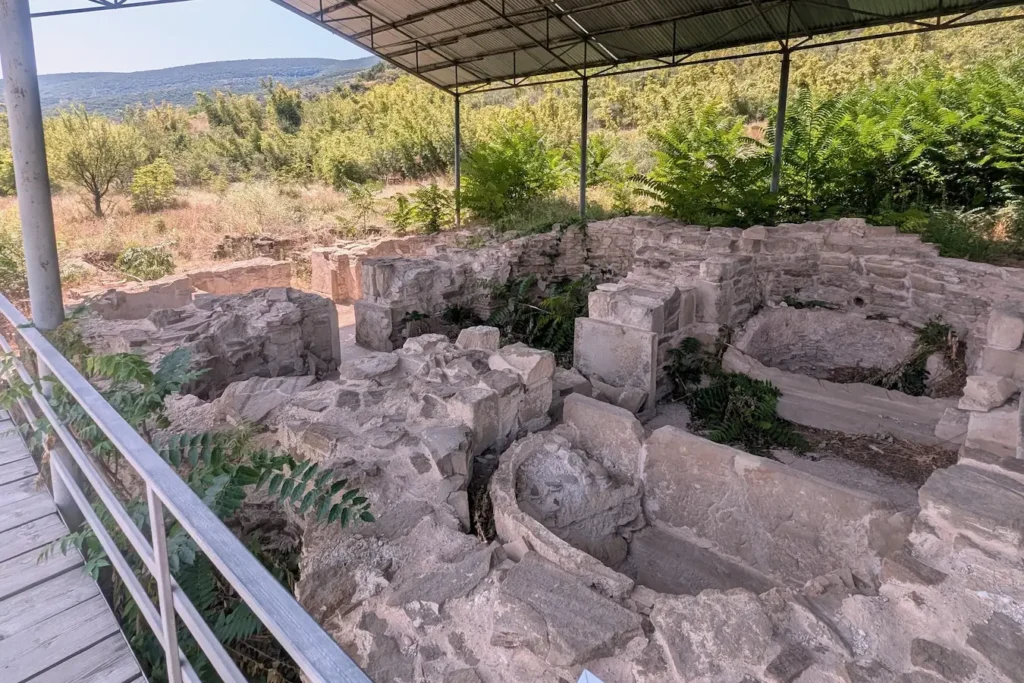
The marked trail leads past the principal ruins, most of which survive as low foundations. Keep the route map open to identify the structures as you walk.
🚶 First site on the trail: The Stone Sarcophagus
The Stone Sarcophagus
The stone sarcophagus is the first major archaeological structure reached along the trail. Dating to approximately the 2nd century CE, it is believed to have been the burial place of a king’s daughter or another woman closely connected with the royal court.
The richness of the burial reflects the status of the woman laid to rest here. Archaeologists discovered gold jewelry, silver vessels, bracelets decorated with carved stones, and silver fittings from a funerary bed. Some objects were made locally, while others reveal the connections that the Kingdom of Kartli maintained with neighboring cultures and distant centers of craftsmanship.
The valuable grave goods were removed for preservation and study and are now held in museum collections.
🚶 Next site on the trail: The Queen’s Bath
The Queen’s Bath
The smaller of the two royal bathhouses at Armaztsikhe–Bagineti is commonly dated to the 2nd–3rd centuries CE. The bath takes its name from an inscription recording that it was built for the queen by a royal official.
The complex included a changing area and bathing rooms maintained at different temperatures. A furnace provided heat, while clay pipes carried water through the building. Bathhouses of this kind were characteristic of the Roman world. It shows us that Kartli had a long relationship with the Roman Empire.
Pompey Bridge, visited later on this route, recalls Rome’s campaign against Kartli in 65 BCE. By 75 CE, relations had moved from conflict toward cooperation: an inscription records that Emperor Vespasian helped strengthen Mtskheta’s defenses. The Queen’s Bath, built later, reflects the growing influence of Roman engineering at the royal court.
🚶 Next site on the trail: The King’s Bath
The King’s Bath
A short distance beyond the Queen’s Bath lies a second complex known as the King’s Bath, or Royal Bath. The name is conventional: unlike the neighboring bath, no inscription identifies the person for whom it was built. It is generally dated to the 3rd–4th centuries CE.
The bath contained several rooms connected by pipes and channels. In the heated rooms, the floors were raised above lower chambers. Hot air from a furnace circulated through these spaces, heating the floors and gradually warming the rooms above. The system worked on much the same principle as modern underfloor heating.
🚶 Next site on the trail: The Ancient Wine Cellar
The Ancient Wine Cellar
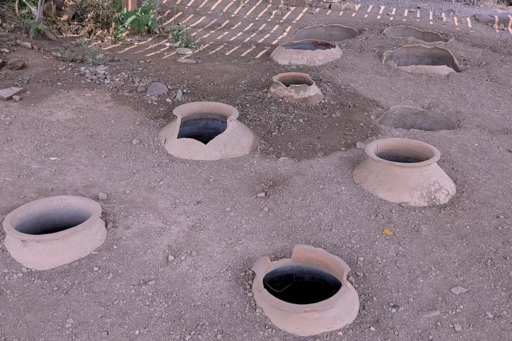
The wine cellar is generally dated to the 3rd–4th centuries CE. Large qvevri — clay vessels used to ferment and store wine — were set into its floor. Together, they could hold approximately 20,000 liters, or about 5,300 gallons.
The scale of the cellar suggests that it served more than the everyday needs of a single household. It stood beside the six-apsed temple, and the wine and other supplies stored here may have been used for religious ceremonies, communal feasts, and the wider economy of the royal complex.
Although the cellar belongs to ancient Armazi, the winemaking method it represents remains part of Georgian life today. Georgian winemakers still ferment and store wine in qvevri buried underground, a tradition particularly associated with Kakheti region.
To learn more about qvevri winemaking and how wine is produced in Georgia today, see the guide to Kakheti, Georgia’s principal wine region.
🚶 Next site on the trail: The Six-Apsed Temple
The Six-Apsed Temple
Beside the wine cellar are the foundations of one of the most unusual buildings at Armaztsikhe–Bagineti. This pagan temple was used during the first few centuries CE. Its destruction in the first half of the 4th century coincided with the adoption of Christianity as the official religion of Kartli. The cellar appears to have been part of this pagan temple, storing wine and food that may have been used during religious ceremonies and communal feasts.
Although the building was rectangular on the outside, its main hall included six rounded spaces arranged around the room. This unusual layout gives the temple its modern name. The decorated stone base still visible near the center once supported a wooden column, which probably helped carry the roof. Fragments of red-painted clay tiles found during excavations show that the roof itself was tiled.
Archaeologists also found a separate carved stone pedestal marked with the outlines of human feet. It may once have supported a statue of a deity worshipped in the temple, although its original position within the building is unknown.
🚶 Next site on the trail: The Two-Cell Structure
The Two-Cell Structure
The next foundations belong to a building known as the Two-Cell Structure. Its modern name simply describes its plan: two adjoining rooms. The building dates to the late Hellenistic period and was among the first structures examined when archaeological work began at Armaztsikhe in 1890.
One of the most notable discoveries was a fragment of wall painting showing part of a woman’s figure, dated to the 1st century CE and now held by the Georgian National Museum. The painting suggests that the interior was once carefully decorated, although the building’s original purpose remains unknown.
🚶 Next site on the trail: The Six-Column Hall
The Six-Column Hall
The final major structure on the archaeological trail is a large rectangular hall named after the six columns that once stood along its central axis. It was built sometime between the 2nd century BCE and the 1st century CE, making it one of the earliest monumental buildings discovered in the royal complex.
Its original purpose remains uncertain. Archaeologists have variously interpreted it as a palace, a royal treasury, or an armory, but the small number of objects found inside has left none of these theories confirmed. The surviving column bases still reveal the scale and formal arrangement of what was clearly an important building.
↩️ The Six-Column Hall is the final site on the main archaeological trail. From here, return toward the entrance along the same path.
🚶 Next (optional visit): Betlemi Virgin Mary Chapel
Betlemi Virgin Mary Chapel (Optional)
📝 How to find: When you are back near the entrance, use the route map to find a small gate on your left. Beyond it, a very steep metal ladder fixed to the cliff leads to the cave chapel.
Near the beginning of the archaeological trail is a small Orthodox chapel associated with Betlemi Cave. Betlemi is the Georgian form of “Bethlehem,” connecting the shrine with the birthplace of Christ.
According to Georgian Christian tradition, Saint Nino found shelter in a cave at the foot of Mount Bagineti after arriving in Mtskheta. From here, she followed people traveling to a festival dedicated to Armazi, the chief deity of the kingdom. A small chapel now marks the place connected with this tradition.
🏁 This is the final site of the hike.
How to Get to Armaztsikhe–Bagineti
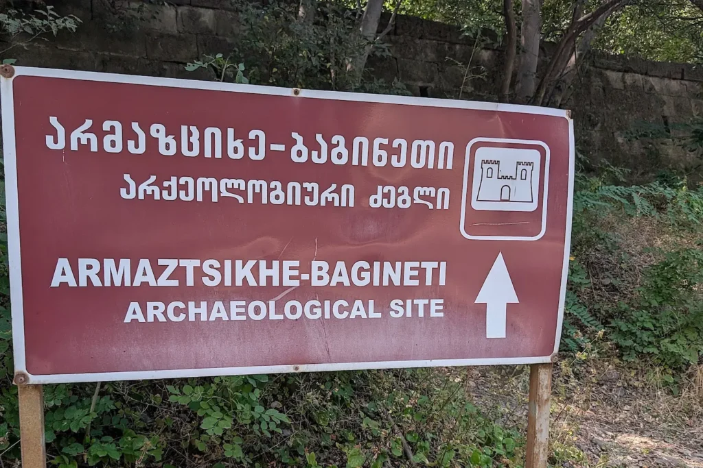
The route map shows two parking options near the Armaztsikhe–Bagineti archaeological site.
Option 1: Parking Near the Entrance via the Dirt Road
From Tbilisi, follow the main road toward Mtskheta and take the turn marked on the route map. A dirt road leads from here to the archaeological site. The final approach is rough and uneven, and parking near the entrance can be difficult.
Option 2: Roadside Parking and a Short Walk
If you prefer to avoid driving on the dirt road, use the roadside parking point marked on the map. This is an open space beside the road rather than a designated parking lot. Keep in mind that there is no sidewalk between the parking spot and the pedestrian entrance; the short walk follows the edge of the road.
🚶 The archaeological trail begins at the pedestrian entrance. Follow the path uphill and use the route map to locate the individual archaeological sites.
➡️ Next stop (optional): Armazi Gorge Hike
2. Armazi Gorge Hike: A Forest Trail to a Medieval Fortress
➕ Optional hike
🚗 Driving time from Armaztsikhe–Bagineti: ~15–20 minutes
🛣️ Road conditions: paved road followed by a narrow, rough approach through Armazi Gorge
⏱️ Hiking time: ~3 hours round trip
🥾 Walking difficulty: moderate, with steep and potentially slippery sections
🌊 River crossing: no bridge; cross using the rocks in the river
🅿️ Parking: designated parking for monastery visitors, marked on the route map
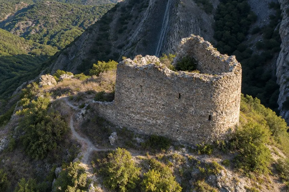
The character of the route changes at this second stop. Instead of walking between excavated structures, you follow a forest trail into Armazi Gorge, cross the Armazistskali River, and follow the forest trail to the ruins of a medieval fortress on a rocky ridge.
The route begins at the active Armazi Monastery and returns along the same path. This is the most demanding walking section of the day, with uneven ground, a river crossing, and limited signs along the trail.
📝 Consider skipping this hike if the terrain feels too difficult or if recent rain has left the ground wet and slippery.
⚠️ The Armazi Gorge hike is moderate but more demanding than the archaeological trail at Armaztsikhe–Bagineti. Allow around three hours for the round trip.
🚶 Starting point for the Armazi Fortress hike: Armazi Monastery
Armazi Monastery
Armazi Virgin Mary Monastery stands on the right bank of the Armazistskali River. Its main church, dedicated to the Virgin Mary, was built between 1150 and 1178. This dating comes from a stone inscription that is now preserved in the Georgian National Museum.
The church was painted soon after its construction. Fragments of the original 12th-century paintings can still be seen near the altar and on the western wall. The complex also includes a small crypt and a two-story bell tower added in the 16th–17th centuries.
🚶 Next: find the start of the hiking trail at Armazi Monastery
Trail Access Through Armazi Monastery
Access to the Armazi Fortress trail passes through the monastery grounds. Walk toward the church and look for the path descending toward the river to the right of the building. The trailhead is marked on the route map, and monastery staff can help you find the path if needed.
📝 Because the route passes through an active monastery, cover your shoulders and knees even if you do not plan to enter the church.
⚠️ Two dogs live on the monastery grounds and may run toward visitors while barking, which can seem intimidating at first. Monastery staff say that the dogs do not bite. Despite their noisy greeting, they are friendly and playful, and one of them likes to accompany visitors along the hiking trail.
🚶 Next: cross the Armazistskali River
Crossing the Armazistskali River
From the monastery, the trail descends toward the Armazistskali River, a small mountain river that flows through Armazi Gorge before joining the Kura River. The crossing point is marked on the route map, but there is no bridge. When conditions allow, cross by stepping carefully across the rocks in the river.
📝 Waterproof hiking shoes, trekking poles, and a spare pair of socks can be useful.
🚶 Next: follow the forest trail to Armazi Fortress
Armazi Fortress
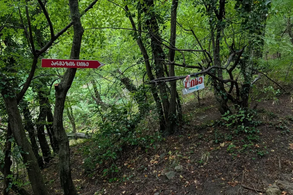
After crossing the river, follow the forest trail toward Armazi Fortress. The ruins stand on a rocky ridge above the gorge. The surviving walls and tower are generally dated to the 13th–14th centuries, although they were built over the remains of an earlier structure.
The elevated position allowed the fortress to overlook movement through the narrow valley and the approaches to Mtskheta. Only sections of the defensive walls and tower survive, but their position still shows why this ridge was chosen for a stronghold.
Armazi Fortress belongs to a later chapter in Mtskheta’s history. By the time it was built, the capital had long since moved to Tbilisi, but Mtskheta remained one of Georgia’s principal spiritual and cultural centers. The surrounding valleys also continued to form part of important regional routes.
↩️ Armazi Fortress is the turnaround point of this out-and-back hike. From here, follow the same trail back to Armazi Monastery.
➡️ Next stop (optional): Armaziskhevi Archaeological Site
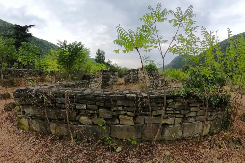
3. Armaziskhevi Archaeological Site
➕ Optional stop
🚗 Driving time from Armazi Monastery: ~5 minutes
🛣️ Road conditions: a short drive on a paved road
⏱️ Time at the site: ~1 hour
🚶 Site type: open-air archaeological field with ancient ruins and graves
🥾 Walking difficulty: easy, but Armaziskhevi has no designated visitor paths; expect to walk through grass over uneven ground
🚻 Facilities: no visitor facilities within the archaeological site
🅿️ Parking: available parking at Armazis Tskaro restaurant or in informal roadside spaces nearby
🚪 Entrance: through a small gate within the restaurant grounds, marked on the route map
⚠️ Snakes may shelter beneath stones, particularly during warmer months. Avoid turning over stones or reaching into gaps between the ruins.
Armaziskhevi was an important district of ancient Mtskheta and the residence and burial ground of the Pitiakhshi, high-ranking officials who served the kings of Kartli. Their role was comparable to that of a regional governor, placing them among the most powerful figures in the kingdom.
Excavations have uncovered the remains of a Pitiakhshi residence, including a palace, bathhouse, wine cellar, water system, pottery workshop, and a necropolis containing 144 graves dating from the 2nd to the 9th centuries. The site offers a view of life beyond the royal acropolis, revealing the wealth and influence of the families who helped govern ancient Kartli.
How to Find the Entrance
The archaeological site is not clearly visible from the road. Follow the route map to Armazis Tskaro restaurant, where access to the ruins passes through the restaurant grounds. After entering the main gate, look for a smaller iron gate on the right that leads into the archaeological field. Both gates are marked on the map, and restaurant staff can help if the entrance is difficult to locate.
Once through the gate, follow the path into the open field. Expect tall grass, uneven ground, and limited signs identifying the ruins.
🚶 Main site: The Pitiakhshi Necropolis
The Pitiakhshi Necropolis
Of the 144 graves uncovered across Armaziskhevi, 19 particularly rich tombs belonged to members of the Pitiakhshi family and date to the 2nd–4th centuries CE. Some of the dead were placed in sarcophagi carved from solid blocks of sandstone, while others were buried in graves constructed from stone slabs.
The contents of the tombs reveal the wealth of the families buried here. The dead were laid on wooden funerary beds with silver-covered feet and accompanied by gold jewelry, silver ceremonial vessels, glassware, and Roman and Parthian coins. Many of the silver and glass objects were imported from Rome or its eastern provinces, while much of the gold jewelry was produced by local craftspeople.
Most of these objects were removed for preservation and study and are now held by the Georgian National Museum in Tbilisi. The stone tombs remain in the archaeological field, giving visitors a sense of what was once one of the richest burial grounds in ancient Kartli.
📜 Key discovery: The Armazi Bilingual Inscription and the story of Serapita
The Armazi Bilingual and Serapita
One of the most important discoveries at Armaziskhevi is a 2nd-century funerary inscription known as the Armazi Bilingual. Found in 1940, it commemorates Serapita, a young noblewoman who died at the age of 21. She was the daughter of Zevakh, a Pitiakhsh, and belonged to a family closely connected with the royal court.
The epitaph was written in Greek and Aramaic. Both versions tell Serapita’s story, although the Aramaic text includes additional details about her family. By naming kings, Pitiakhshi, and members of the royal court, the inscription also helped historians understand how the kingdom was governed.
🏛️ The original stone is no longer at the archaeological site. You can find it in the collection of the Georgian National Museum in Tbilisi.
The Pitiakhshi Residence
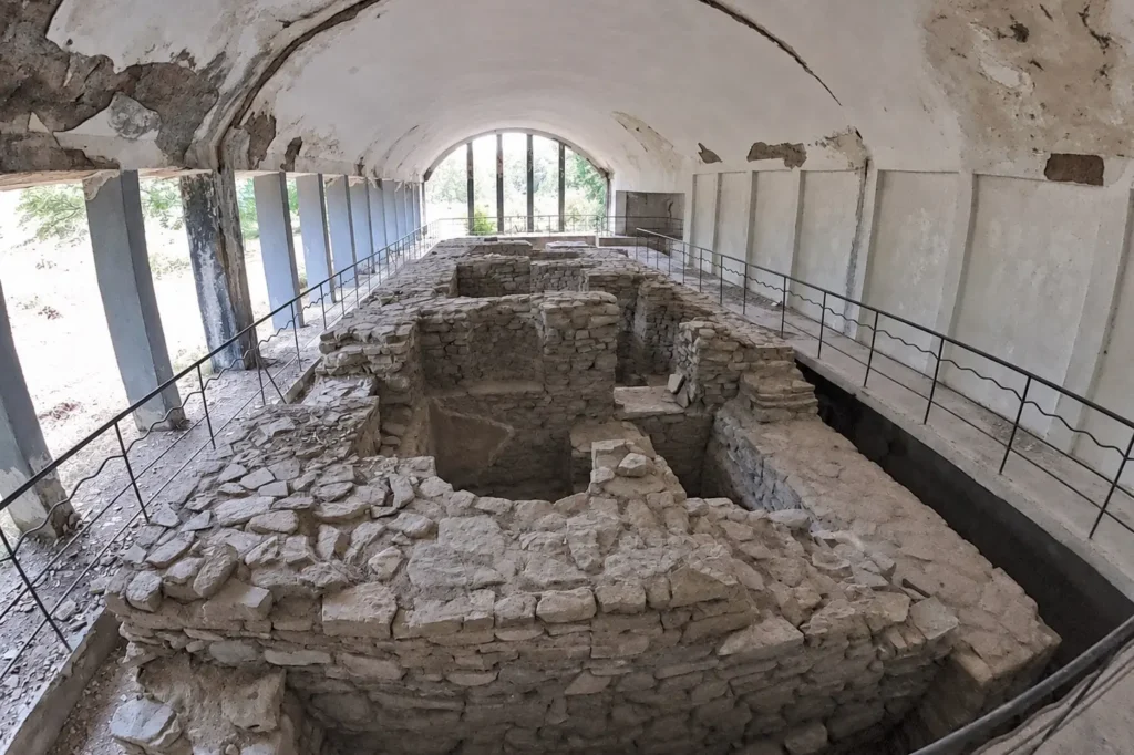
Armaziskhevi was more than a burial ground. Beside the necropolis stood the residence of the Pitiakhshi, with a palace, bathhouse, wine cellar, water system, and pottery workshop. Together, these buildings formed a working estate where some of Kartli’s most senior officials lived and carried out their duties.
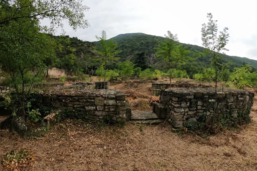
The palace was a substantial stone building with a tiled roof. Finely carved architectural fragments discovered during excavations — including parts of doorframes, columns, and decorative stonework — suggest that the palace was once carefully designed and richly finished.
↩️ After exploring the ruins, walk back through the restaurant grounds to your car.
➡️ Next stop (optional): Pompey Bridge
4. Pompey Bridge: A Submerged Crossing on the Kura River
➕ Optional roadside stop
🚗 Driving time from Armaziskhevi Archaeological Site: ~5–10 minutes
🛣️ Road conditions: paved road
⏱️ Time at the site: ~10 minutes
🚶 Site access: roadside viewpoint
👁️ Visibility: the remains are often partly or completely underwater
🚻 Facilities: no visitor facilities at the bridge
🅿️ Parking: roadside stopping point marked on the route map
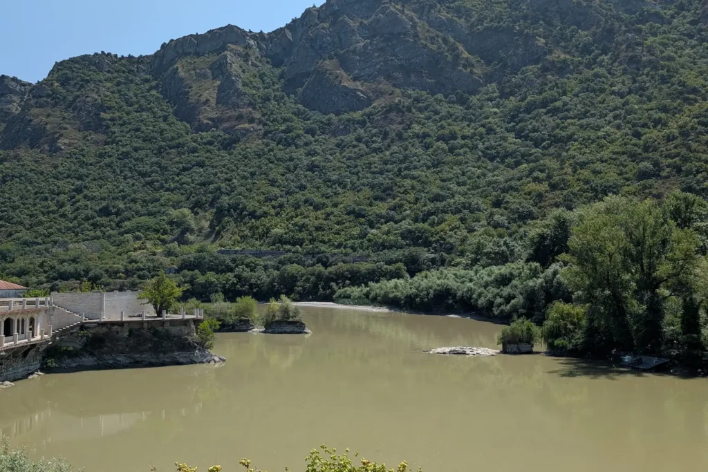
Pompey Bridge lies in the Kura River near the entrance to Mtskheta. The amount of the structure visible above the water changes with the river level, and at times almost nothing can be seen from the bank.
Despite its name, the bridge was not built by the Roman general Pompey. A crossing already existed here when he invaded Kartli in 65 BCE. According to historical accounts, King Artag retreated across the Kura and burned the bridge behind him as Pompey’s army approached. The later name preserves the memory of this campaign.
The bridge was rebuilt several times over the centuries. The last major reconstruction took place in 1839–1841, when a stone-arched bridge replaced the older structure while incorporating some of its remains. It was submerged in 1926 after the construction of the Zemo Avchala hydroelectric dam. The ruins visible today therefore belong mainly to the 19th-century bridge rather than to an intact Roman structure.
➡️ Next stop: dinner at Sasperia Restaurant in Mtskheta
5. Dinner in Mtskheta: Sasperia Restaurant
🍽️ Suggested dinner stop
🚗 Driving time from Pompey Bridge: ~5–10 minutes to the restaurant parking area
⏱️ Time at the restaurant: ~1.5 hours
🍴 Cuisine: Georgian, European
🅿️ Parking: find any available parking spot nearby
📞 Reservation: recommended for a terrace table, especially on weekends
After exploring the ruins around Armazi, the route ends back in Mtskheta at Sasperia Restaurant.
The restaurant’s terrace overlooks the city, with views of Svetitskhoveli Cathedral and Jvari Monastery — two of Mtskheta’s principal landmarks included in the city’s UNESCO World Heritage listing. They are covered in more detail in the Tbilisi to Mtskheta day trip itinerary.
🏁 This is the final stop.
Suggested One-Day Itinerary and Timing
The following schedule assumes a 9:00 a.m. departure from central Tbilisi, normal traffic, and reasonably dry trail conditions. It shows the complete itinerary, including the optional Armazi Gorge hike, Armaziskhevi Archaeological Site, and Pompey Bridge.
The gaps between stops are intentional. They provide time for parking, finding entrances, changing shoes, and small delays. The longer break before the Armazi Gorge hike also allows time for a packed lunch, as there are no reliable food facilities along the trail.
| Time | Location | Time allocated | What the timing includes |
|---|---|---|---|
| Travel from Tbilisi 🚗 | |||
| 9:00 a.m. | Leave central Tbilisi | ~1 hour | Drive to Armaztsikhe–Bagineti with a traffic and parking buffer |
| Ancient Armazi 🏛️ | |||
| 10:00–11:00 a.m. | Armaztsikhe–Bagineti | 1 hour | Main archaeological trail and the optional Betlemi chapel |
| 11:00 a.m.–12:30 p.m. | Transfer and lunch break | 1 hour 30 minutes | Have a packed lunch, then drive to Armazi Monastery before beginning the hike. |
| Armazi Gorge 🥾 | |||
| 12:30–3:30 p.m. | Armazi Gorge and Armazi Fortress | 3 hours | Monastery, forest trail, fortress, and return hike |
| Armaziskhevi and Mtskheta 🏺 | |||
| 3:40–4:40 p.m. | Armaziskhevi Archaeological Site | 1 hour | Entrance, Pitiakhshi Necropolis, and surviving foundations |
| 5:10–5:20 p.m. | Pompey Bridge | 10 minutes | Optional roadside view in Mtskheta |
| Dinner in Central Mtskheta and Return to Tbilisi 🍽️ | |||
| 5:40–7:10 p.m. | Dinner at Sasperia Restaurant in Mtskheta | 1 hour 30 minutes | Dinner and terrace views of Mtskheta’s principal landmarks |
| ~8:00 p.m. | Approximate arrival in Tbilisi | — | End of the route |
📝 The Armazi Gorge hike, Armaziskhevi Archaeological Site, and Pompey Bridge are optional, allowing the itinerary to be shortened or adapted. If you prefer a day with less hiking, visit Armaztsikhe–Bagineti and then continue into central Mtskheta. The Tbilisi to Mtskheta day trip itinerary can be used to add the principal sights of central Mtskheta to this route, including Svetitskhoveli Cathedral, Samtavro Monastery, and the historic streets of the Old Town.
FAQ: How to Prepare for the Armazi Ruins Hiking Route
Do I Need an SUV for This Route?
An SUV is not required to visit Armaztsikhe–Bagineti if you use the alternative roadside parking point marked on the route map and walk to the pedestrian entrance. The roads to Armaziskhevi, Pompey Bridge, and central Mtskheta are also accessible by an ordinary passenger car.
A higher-clearance vehicle is preferable for the optional drive into Armazi Gorge.
Where Can I Rent a Car for the Armazi Route?
Travelers can compare rental options through Localrent, which works with local rental companies and presents rental terms clearly, or GetRentacar, where rental companies and private owners offer vehicles for different budgets.
If you plan to include the optional Armazi Gorge hike, choose a vehicle with sufficient ground clearance and confirm that the rental agreement permits driving on unpaved roads.
Can This Route Be Done Without a Car?
Completing the full route by public transportation would be difficult because the archaeological areas are spread across several separate access points. There is no single walking trail connecting them, and local transportation does not run directly between every stop.
For a shorter car-free trip, visit Armaztsikhe–Bagineti by taxi and then continue to central Mtskheta, where the principal landmarks can be explored on foot. Mtskheta’s principal landmarks are covered in the Tbilisi to Mtskheta day trip route.
When Is the Best Time for this Hike?
Late spring and early autumn generally offer the most comfortable temperatures for this route. Early autumn is particularly suitable because the ground is often drier, while spring brings greener landscapes but can also mean mud and higher water levels in the river.
In summer, begin early to avoid the strongest afternoon heat. Armaztsikhe–Bagineti has little shade, although much of the Armazi Gorge trail passes through forest. Winter visits are possible in dry weather, but short daylight hours, ice, and wet ground can make the hike more difficult.
What Shoes and Clothing Should I Bring?
Wear sturdy, closed-toe hiking shoes with good grip. Waterproof footwear is useful on muddy sections and at the river crossing, but keep spare shoes and socks in the car in case your feet get wet.
Lightweight long pants are more practical than shorts because parts of the route pass through tall grass and overgrown ruins. Bring a sun hat and sunscreen for Armaztsikhe–Bagineti, where shade is limited, and carry a light outer layer for cooler or windy weather.
The Armazi Gorge hike begins within the grounds of an active monastery, so wear clothing that covers your shoulders and knees. Trekking poles are optional but can provide extra stability on slippery ground and during the river crossing.
Are the Archaeological Sites Maintained?
Armaztsikhe–Bagineti and Armaziskhevi are recognized archaeological areas, but visitors should not expect the facilities or interpretation found at a conventional museum. Some paths, fences, and protective structures remain, while signs are limited and sections of the sites may be covered by tall grass. Many ruins survive as exposed foundations, making individual buildings difficult to identify without the route map.
Armazi Fortress is also unrestored, with damaged walls and unprotected edges.
What Should I Know About Tall Grass and Snakes?
Tall grass is common throughout the hiking sections of this route, and thorny plants grow along parts of the trails. Wear long pants to protect your legs from scratches and irritation.
Encounters with snakes are uncommon, but they may shelter beneath stones or inside gaps between the ruins. Avoid turning over rocks, reaching into gaps, or stepping anywhere you cannot see clearly.
Useful Links & Official Sources
The following resources provide further information about the archaeological sites, historic buildings, and practical considerations covered in this route:
Armaztsikhe–Bagineti Archaeological Site:
Armaztsikhe — Georgian Encyclopedia
An overview of the ancient royal acropolis, its archaeological layers, fortifications, baths, and other surviving structures.
Armazi Monastery and Fortress:
Armazi of Mtskheta — Georgian Encyclopedia
Information about Armazi Monastery and the medieval fortress above the gorge.
Armaziskhevi and the Pitiakhshi Necropolis:
Armaziskhevi Archaeological Site — Georgia Travel
A summary of the Pitiakhshi residence, necropolis, and archaeological discoveries made at the site.
The Armazi Bilingual Inscription — Georgian Encyclopedia
Background on the Greek and Aramaic inscription dedicated to Serapita and its importance to the study of ancient Kartli.
Travel Planning Tools
Car Rental Options in Georgia:
Localrent or GetRentacar
Localrent focuses on local rental companies and clearly presented rental terms, while GetRentacar allows travelers to compare offers from both rental companies and private owners.
Find Flights to Tbilisi:
Aviasales
Compare routes, schedules, and fares for flights to Tbilisi.